-
Call us anytime
+91 99988 89595 - Info@Jet3dscan.Com
-
23/A Mrudul Park, Part 2, Sattadhar Cross Road, Sola Road, Ahmedabad-380061. Gujarat, INDIA.
-
 India Office
-
23/A Mrudul Park, Part 2, Sattadhar Cross Road, Sola Road, Ahmedabad-380061. Gujarat, INDIA.
- +91 99988 89595
- +91 94260 08878
- Info@Jet3dscan.Com
-
-
 Canada Office
-
WINDSOR, ONTARIO, CANADA
- +1 204 998-7772
- Info@Jet3dscan.Com
-


3D SCAN to CAD INSPECTION

Using 3D Scanning techniques, the captured point cloud data through contact and non-contact scanners if overlapped with existing CAD models to address many use cases like to map surface deviation,inspection results etc.
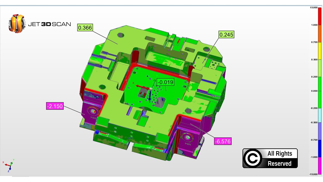
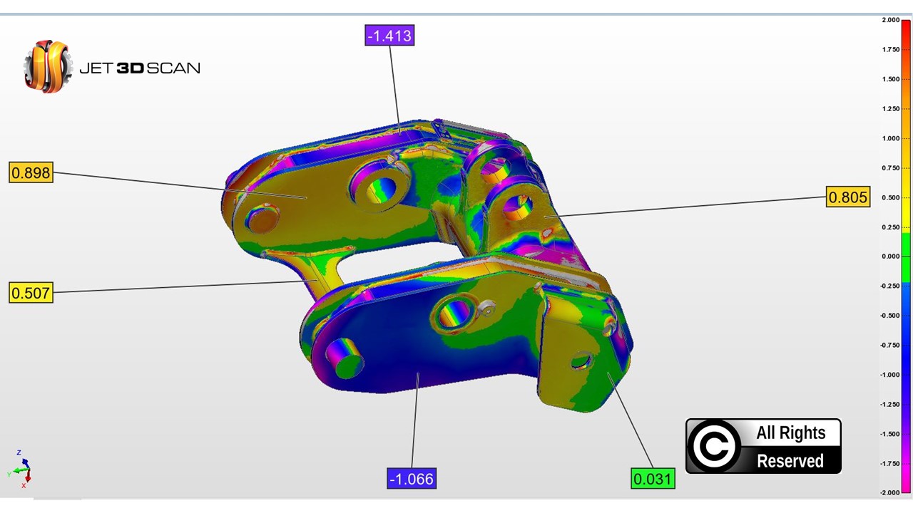


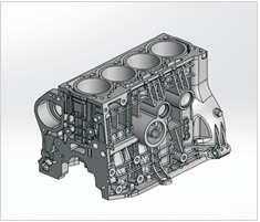
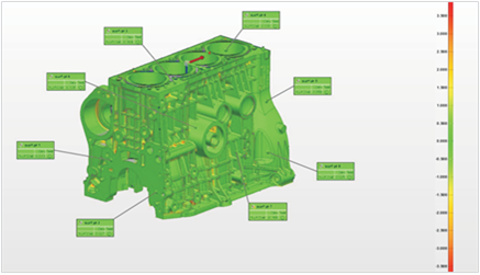
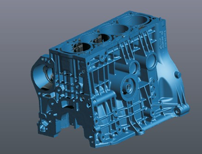


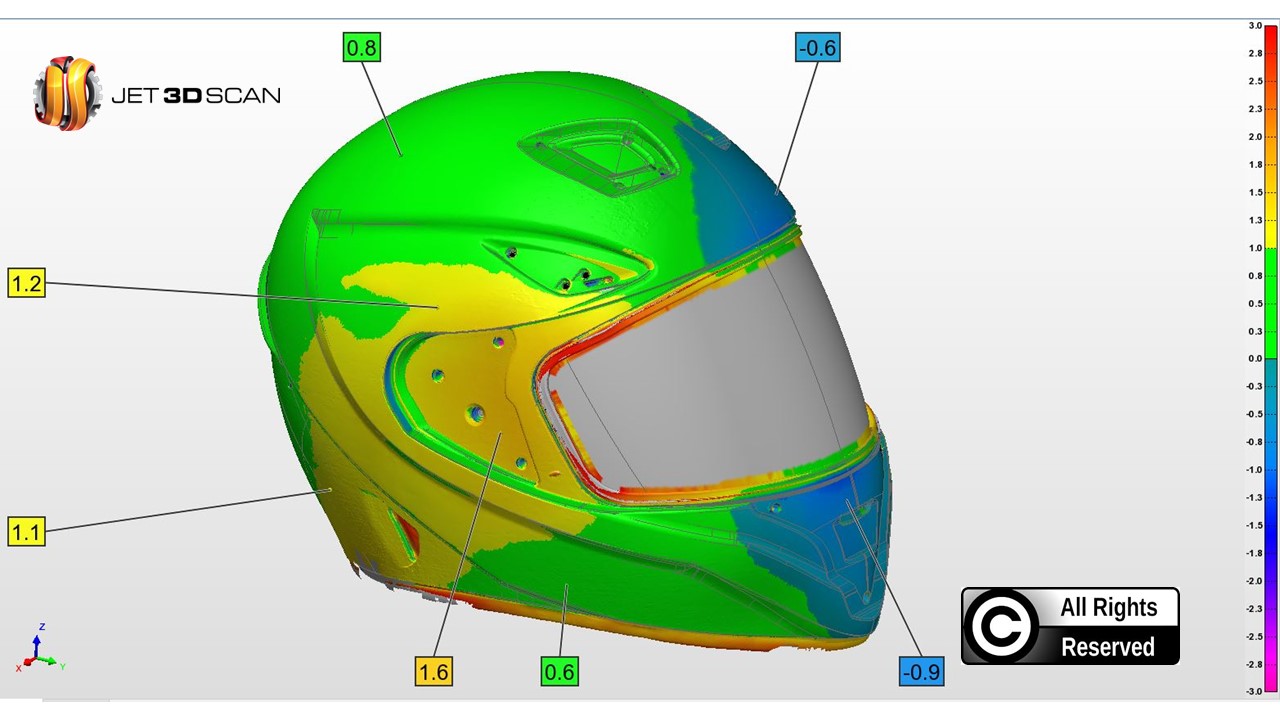
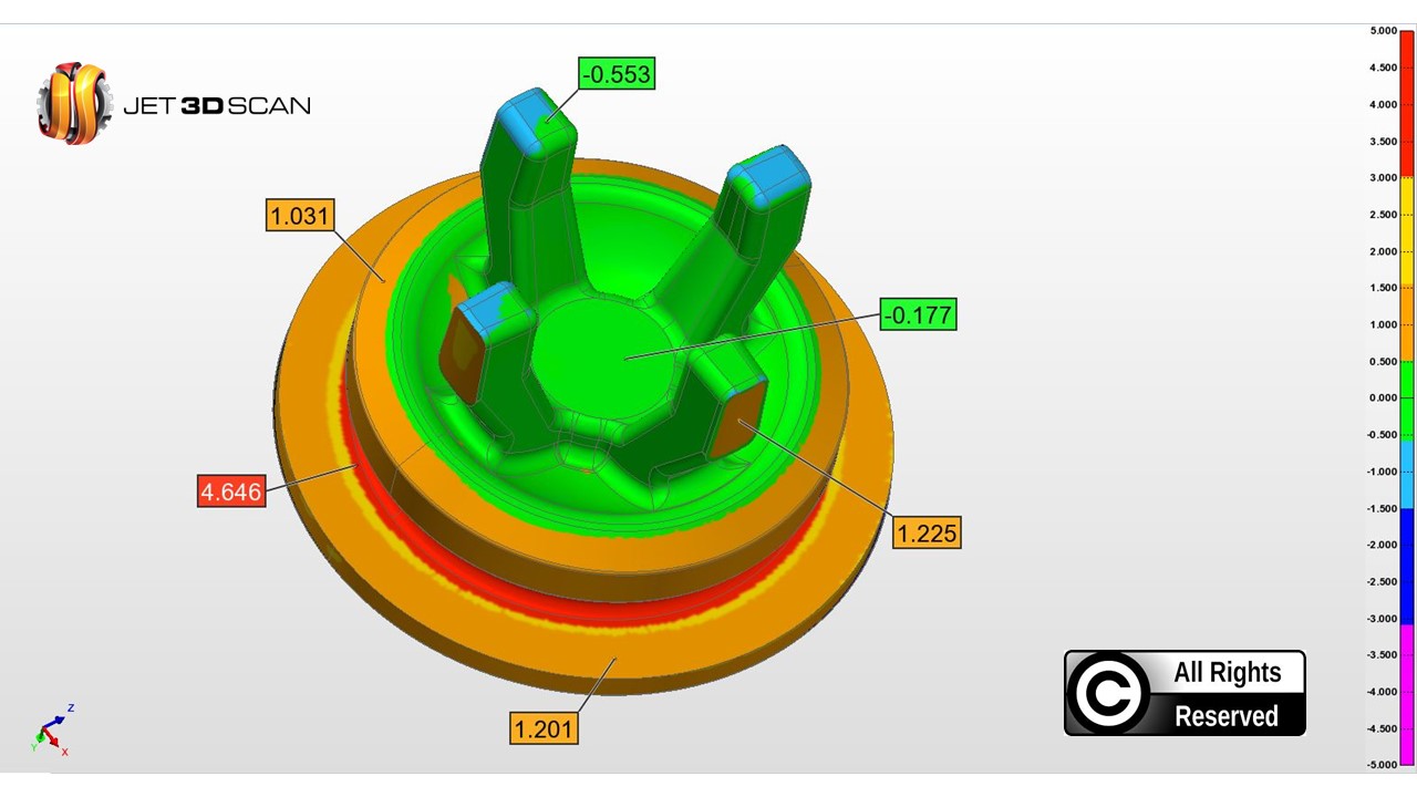
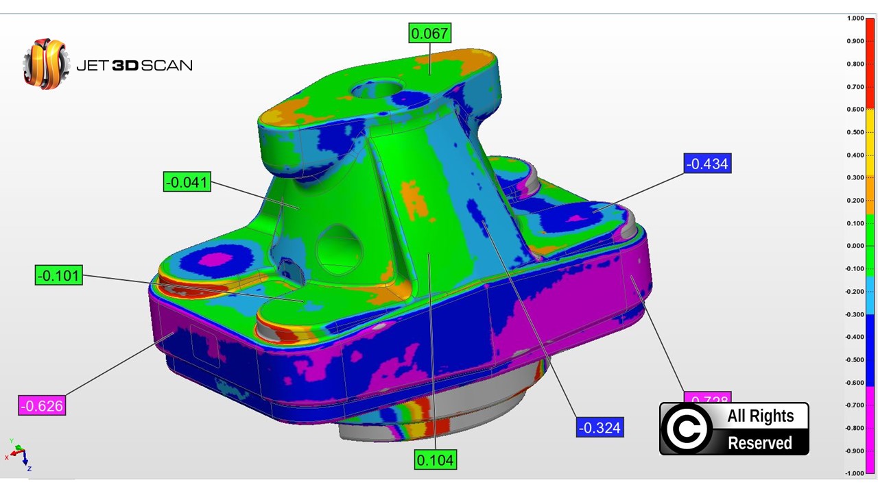
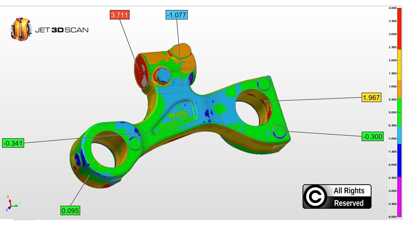
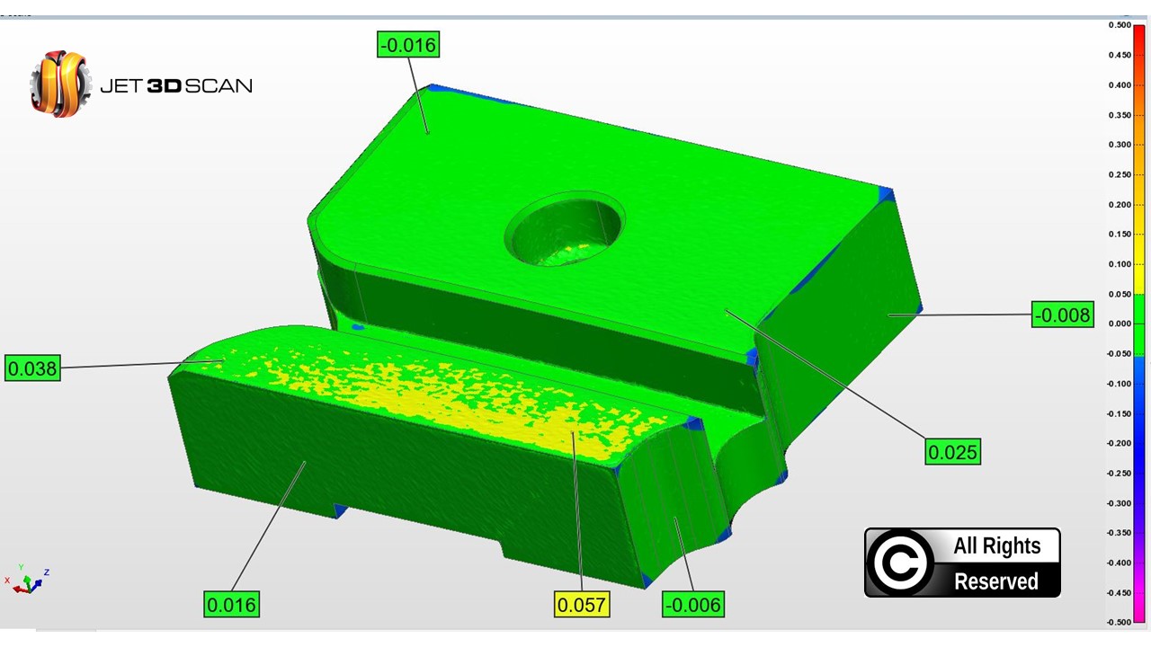


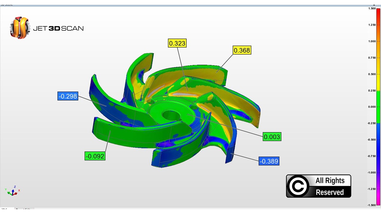
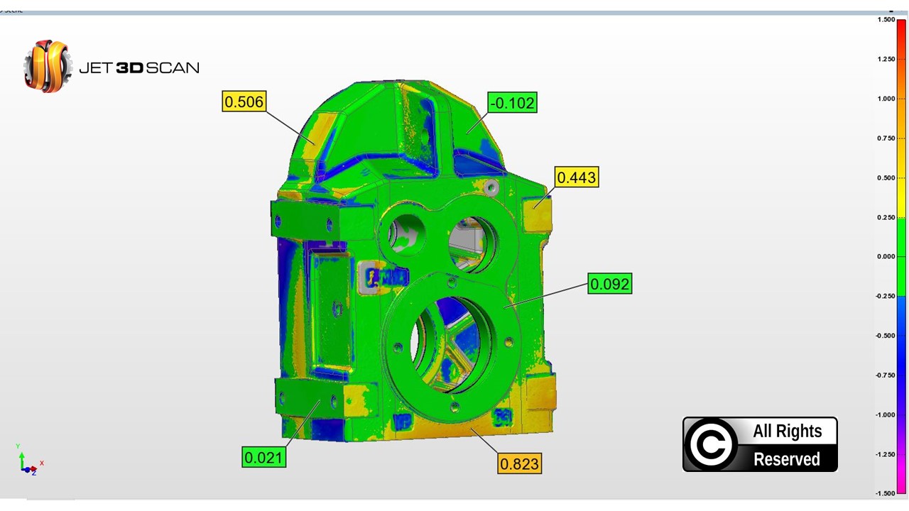
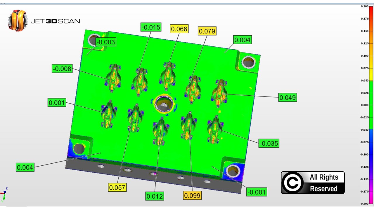


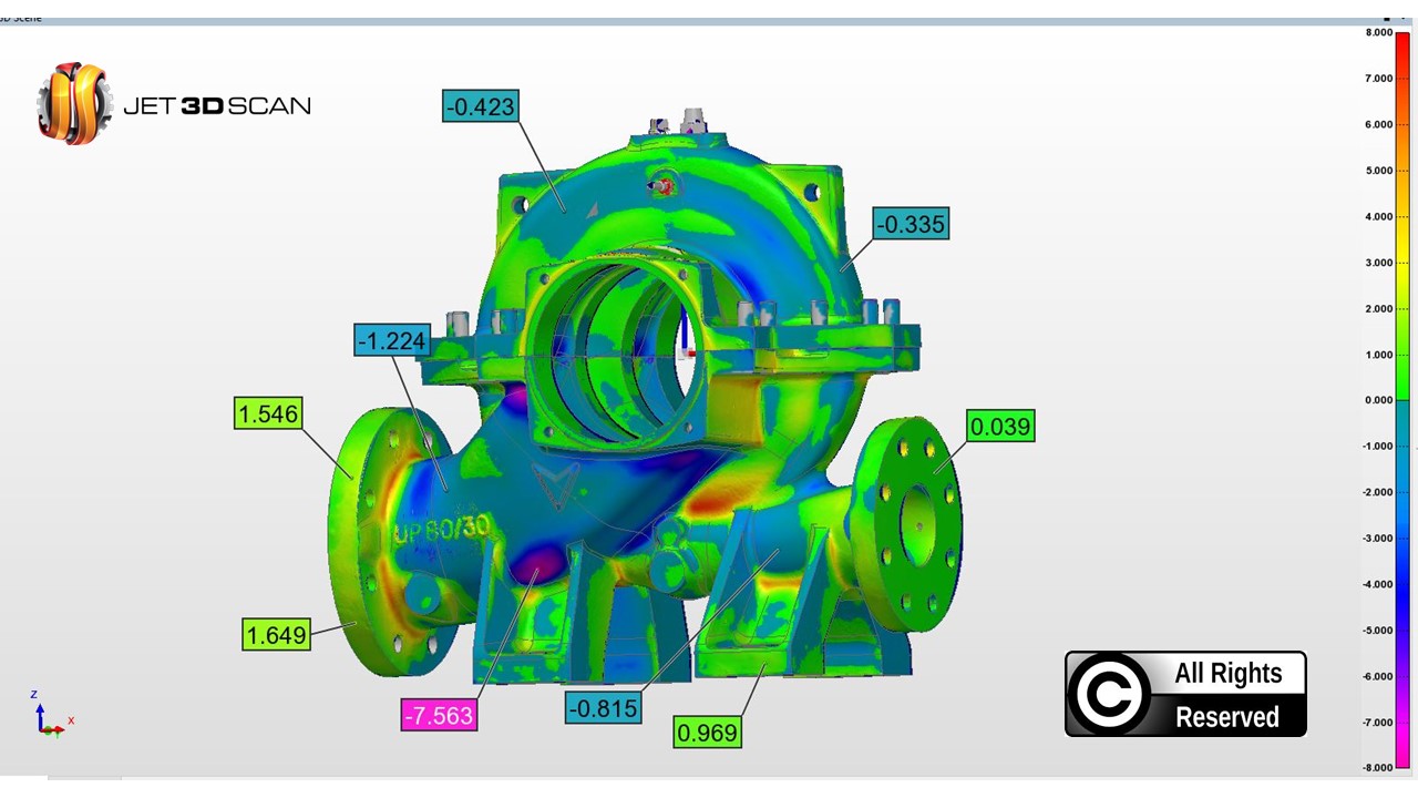


Using advanced 3D scanning techniques, via contact or non-contact acquisition methods, high-density point clouds or tessellated polygonal meshes are captured and aligned to nominal CAD geometry. Through automated CAD-to-part comparison, this scan dataset generates a dynamic full-field surface deviation color map. This enables rapid, visual identification of geometric variances, structural warpage, and tolerance compliance within a significantly reduced inspection cycle.
TECHNICAL ADVANTAGES & STRATEGIC BENEFITS OF 3D SCAN-TO-CAD INSPECTION:
- Flush & Gap Analysis for Mating Assemblies: Evaluates interfacial clearance and alignment tolerances, including flushness and gap metrics, across complex mating components, guaranteeing first-time assembly fitment and preventing downstream interference errors.
- Capture of Engineering Modifications: Identifies and documents unmodeled shop-floor adaptations, tool modifications, and manual engineering refinements directly from manufactured physical parts back into the CAD system.
- Rapid Nominal vs. Deviation Analysis: Streamlines quality control by providing high-throughput 3D surface comparisons between nominal design models and physical production parts.
- Full-Field Omnidirectional Feature Inspection: Eliminates blind spots inherent to single-point probing by simultaneously evaluating line-of-sight geometries, undercut profiles, and complex organic surfaces from all angles in a single coordinate system.
- Interactive Cross-Sectional & Volumetric Defect Analysis: Executes detailed 2D cross-sectional slice analysis across internal or thin-walled features to detect structural warpage, wall-thickness variations, and core shifts prior to tooling sign-off.
 First of all Thank you to get done my work "Excellent", very supportive team, excellent service on time delivery. Sound in knowledge and Technology, proper guideline to save time and money. Thank You.
It is located at Sola (Ahmedabad). It is provided 3D work as Drawing,Inspection,Simulation and other 3D related Works.also i appreciation on him service.
Very very good experience Jayneel Patel.. Always ready to do critical work and give best results..
Excellent works quality, very good person as a businessman….
Given material before committed time…...
Excellent service provider.I want Reverse engineering & 3D scan model and they give me great response.Very very very impressive and accurate work.
The team is very cooperative and they provide excellent service and support. Has some of the latest technologies and well versed with its applicability. Overall the team is very helpful and had very s...
Excellent services ! They completed the job with high precision and before time! I want Reverse engineering & 3D scan model and they give me great response. Very very very impressive and accurate work...
Great place to make 3D CAD MODELS of your ideas and also to have its wonderful output on 3D printer at very good cost.
First of all Thank you to get done my work "Excellent", very supportive team, excellent service on time delivery. Sound in knowledge and Technology, proper guideline to save time and money. Thank You.
It is located at Sola (Ahmedabad). It is provided 3D work as Drawing,Inspection,Simulation and other 3D related Works.also i appreciation on him service.
Very very good experience Jayneel Patel.. Always ready to do critical work and give best results..
Excellent works quality, very good person as a businessman….
Given material before committed time…...
Excellent service provider.I want Reverse engineering & 3D scan model and they give me great response.Very very very impressive and accurate work.
The team is very cooperative and they provide excellent service and support. Has some of the latest technologies and well versed with its applicability. Overall the team is very helpful and had very s...
Excellent services ! They completed the job with high precision and before time! I want Reverse engineering & 3D scan model and they give me great response. Very very very impressive and accurate work...
Great place to make 3D CAD MODELS of your ideas and also to have its wonderful output on 3D printer at very good cost.